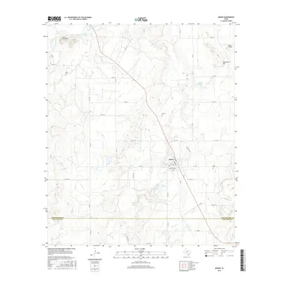
2016 Map of Moran
USGS Topo · Published 2016About this map
Moran serves as the central hub of this West Texas landscape, positioned where the Shackelford Co and Callahan Co line divides the southern terrain. The area's geography is defined by prominent elevations such as the Greer Mountains to the northwest and the distinctive Round Top Mtn and Mugginsville Mtn rising in the northeast. Water management is central to the local infrastructure, with Moran City Lake and Moran Lake situated just south of the town center, while Hubbard Creek meanders through the northern reaches of the quadrangle.
Find a feature on this map
51 named features on this map. Tap any name to fly to it.
Don’t see what you’re looking for? This feature index may not catch every label — zoom into the map to look around manually.
Map Details
Editions of this 2016 Moran Map
This is the sole edition of this map. No revisions or reprints were ever made.
Other maps of this area

1892 · Albany
USGS Topo · 1:125,000

1893 · Albany
USGS Topo · 1:125,000

1931 · Baird
USGS Topo · 1:125,000

1932 · Baird
USGS Topo · 1:125,000

1954 · Abilene
USGS Topo · 1:250,000

1958 · Abilene
USGS Topo · 1:250,000

1961 · Eolian
USGS Topo · 1:24,000

1965 · Albany
USGS Topo · 1:24,000

1965 · McCatherine Mountain
USGS Topo · 1:24,000
1965 · Snyder Lake
USGS Topo · 1:24,000