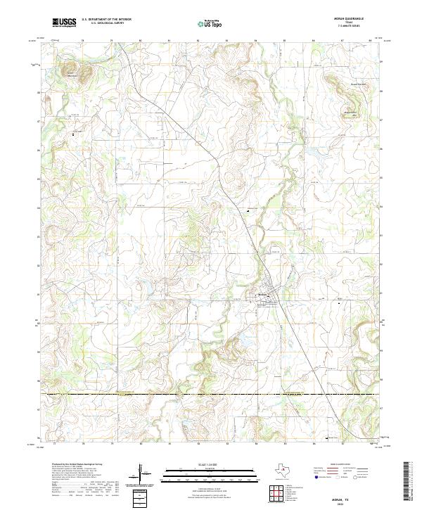
2022 Map of Moran
USGS Topo · Published 2022About this map
Moran serves as the central hub of this West Texas landscape, situated right at the boundary where Shackelford and Callahan Counties meet. The town's grid is defined by historic thoroughfares like Railroad St and Fisher St, pointing to a legacy of early transport and local commerce. To the north, the terrain rises into the Greer Mountains, while Mugginsville Mtn and Round Top Mtn stand as prominent landmarks to the northeast. Water management is a defining characteristic of the modern era, with Moran Lake, Johnson Lake, and Wylie Lake punctuating the ranchlands. For those tracing family histories in the region, the map documents several burial sites including Moran Cem, Greer Cem, Johnson Cem, and Dennis Cem. The drainage patterns of Hubbard Creek and Cordwood Cr further illustrate the geography that dictated the placement of these early Texas settlements and rural roads.
Find a feature on this map
49 named features on this map. Tap any name to fly to it.
Don’t see what you’re looking for? This feature index may not catch every label — zoom into the map to look around manually.
Map Details
Editions of this 2022 Moran Map
This is the sole edition of this map. No revisions or reprints were ever made.
Other maps of this area

1892 · Albany
USGS Topo · 1:125,000

1893 · Albany
USGS Topo · 1:125,000

1931 · Baird
USGS Topo · 1:125,000

1932 · Baird
USGS Topo · 1:125,000

1954 · Abilene
USGS Topo · 1:250,000

1958 · Abilene
USGS Topo · 1:250,000

1961 · Eolian
USGS Topo · 1:24,000

1965 · Albany
USGS Topo · 1:24,000

1965 · McCatherine Mountain
USGS Topo · 1:24,000
1965 · Snyder Lake
USGS Topo · 1:24,000