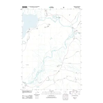
2012 Map of Moran
USGS Topo · Published 2012About this map
The Snake River winds through this 2012 survey, defining a landscape shaped by both natural hydrology and early 20th-century settlement. This portion of the valley features several historically significant outposts, including the Moose Head Ranch, Wolff Ranch, and the Triangle X Ranch. The presence of the Cunningham Cabin highlights the area's homesteading history, while the small settlements of Moran and Elk serve as focal points for local geography and transportation.
Find a feature on this map
49 named features on this map. Tap any name to fly to it.
Don’t see what you’re looking for? This feature index may not catch every label — zoom into the map to look around manually.
Map Details
Editions of this 2012 Moran Map
This is the sole edition of this map. No revisions or reprints were ever made.
Other maps of this area

1899 · Grand Teton
USGS Topo · 1:125,000

1901 · Grand Teton
USGS Topo · 1:125,000

1902 · Mt Leidy
USGS Topo · 1:125,000

1955 · Driggs
USGS Topo · 1:250,000

1958 · Driggs
USGS Topo · 1:250,000

1962 · Driggs
USGS Topo · 1:250,000

1965 · Davis Hill
USGS Topo · 1:24,000

1965 · Mount Leidy
USGS Topo · 1:24,000
1965 · Whetstone Mountain
USGS Topo · 1:24,000

1968 · Moose
USGS Topo · 1:24,000