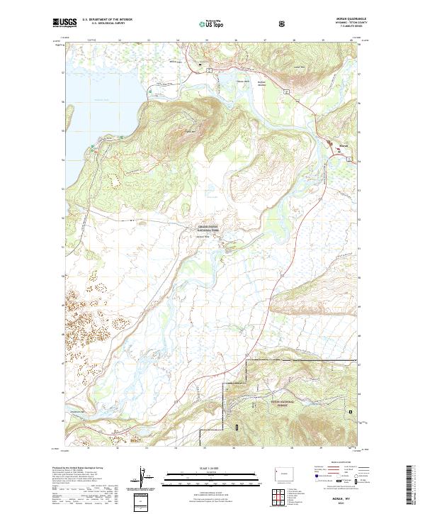
2021 Map of Moran
USGS Topo · Published 2021About this map
Jackson Lake and the winding course of the Snake River dominate this modern topographical record of the Teton wilderness. Near the northeastern shore, the settlement of Moran sits at a critical junction where the Snake River Headwaters Wild and Scenic River flows from the reservoir. This area serves as a gateway to the high-country terrain of Grand Teton National Park and the adjacent Teton National Forest. Local history and geography are anchored by landmarks such as Signal Mtn, which rises above Willow Flats, and the commemorative site at Moran Cem. To the south, the river braids through the valley floor of Jackson Hole, passing the notable site at Deadmans Bar. The map meticulously details the modern road network, including the Teton Park Road and the North-South Highway, which provide access to more remote locations like Oxbow Bend and the meadows bordering Lozier Hill.
Find a feature on this map
42 named features on this map. Tap any name to fly to it.
Don’t see what you’re looking for? This feature index may not catch every label — zoom into the map to look around manually.
Map Details
Editions of this 2021 Moran Map
This is the sole edition of this map. No revisions or reprints were ever made.
Other maps of this area

1899 · Grand Teton
USGS Topo · 1:125,000

1901 · Grand Teton
USGS Topo · 1:125,000

1902 · Mt Leidy
USGS Topo · 1:125,000

1955 · Driggs
USGS Topo · 1:250,000

1958 · Driggs
USGS Topo · 1:250,000

1962 · Driggs
USGS Topo · 1:250,000

1965 · Davis Hill
USGS Topo · 1:24,000

1965 · Mount Leidy
USGS Topo · 1:24,000
1965 · Whetstone Mountain
USGS Topo · 1:24,000

1968 · Moose
USGS Topo · 1:24,000