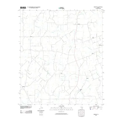
2010 Map of Moravia
USGS Topo · Published 2010About this map
The West Navidad River and Big Rocky Creek dominate this 2010 landscape in Lavaca County, where traditional Texas farm-to-market roads connect small, long-established communities. The settlement pattern here reflects the region's rural heritage, anchored by places like Moravia and Kinkler, alongside smaller locales such as Gleckler and Breslau. A notable shift in local geography is evident in the identification of Old Kinkler separate from the current Kinkler, providing a specific target for those studying the migration of community centers over time.
Find a feature on this map
62 named features on this map. Tap any name to fly to it.
Don’t see what you’re looking for? This feature index may not catch every label — zoom into the map to look around manually.
Map Details
Editions of this 2010 Moravia Map
This is the sole edition of this map. No revisions or reprints were ever made.
Other maps of this area

1901 · Flatonia
USGS Topo · 1:125,000

1919 · Schulenburg
USGS Topo · 1:62,500

1953 · Seguin
USGS Topo · 1:250,000

1958 · Seguin
USGS Topo · 1:250,000

1962 · Sublime
USGS Topo · 1:24,000

1962 · Hallettsville
USGS Topo · 1:24,000

1965 · Oakland
USGS Topo · 1:24,000
1965 · Weimar
USGS Topo · 1:24,000

1965 · Schulenburg
USGS Topo · 1:24,000

1965 · Wied
USGS Topo · 1:24,000