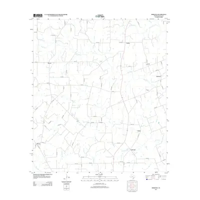
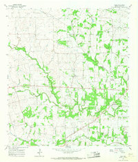
2013 Map of Moravia
USGS Topo · Published 2013About this map
Moravia and the surrounding rural landscapes of Lavaca County are defined by a network of creeks and small drainages that feed into the Lavaca River and the W Navidad River. This 2013 survey illustrates a region largely partitioned by country roads and farm-to-market routes, connecting scattered settlements such as Breslau, Gleckler, and Hackberry. The terrain is punctuated by Appelt Hill and drained by numerous tributaries including Big Rocky Cr, Mixon Cr, and Mule Spring Br. Genealogists and local historians will find value in the precise locations of the Andrew Chapel Cem and Williams Cem, as well as the distinct positioning of Old Kinkler relative to the contemporary Kinkler settlement. The map reveals a persistent agricultural land-use pattern where homesteads and small communities remain tied to the undulating geography of the river basins.
Find a feature on this map
75 named features on this map. Tap any name to fly to it.
Don’t see what you’re looking for? This feature index may not catch every label — zoom into the map to look around manually.
Map Details
Editions of this 2013 Moravia Map
This is the sole edition of this map. No revisions or reprints were ever made.
Other maps of this area
1901 · Flatonia
USGS Topo · 1:125,000
1919 · Schulenburg
USGS Topo · 1:62,500

1953 · Seguin
USGS Topo · 1:250,000

1958 · Seguin
USGS Topo · 1:250,000
1962 · Sublime
USGS Topo · 1:24,000
1962 · Hallettsville
USGS Topo · 1:24,000
1965 · Oakland
USGS Topo · 1:24,000
1965 · Weimar
USGS Topo · 1:24,000
1965 · Schulenburg
USGS Topo · 1:24,000
1965 · Wied
USGS Topo · 1:24,000