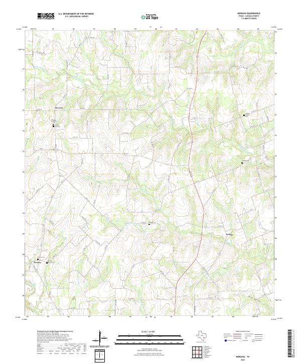
2022 Map of Moravia
USGS Topo · Published 2022About this map
Moravia and the surrounding rural landscape of Lavaca County are defined by a network of creeks and small family settlements. This area is characterized by its numerous historic burial sites, including the Moravia Ascension Cem and the Moravia SPJST Cem, which point to the diverse cultural and fraternal history of the region. The drainage patterns are intricate, with Big Rocky Cr and Little Rocky Cr carving through the terrain towards the W Navidad River in the northeast, while the Lavaca River touches the southwestern corner. In the south, the community of Breslau is marked by the Breslau Cem and Breslau Black Cem, reflecting the segregated history common to early Texas settlements. Narrow county roads and farm-to-market routes like FM 957 and FM 532 connect these small hubs, preserving a traditional Texas ranching and farming layout.
Find a feature on this map
77 named features on this map. Tap any name to fly to it.
Don’t see what you’re looking for? This feature index may not catch every label — zoom into the map to look around manually.
Map Details
Editions of this 2022 Moravia Map
This is the sole edition of this map. No revisions or reprints were ever made.
Other maps of this area

1901 · Flatonia
USGS Topo · 1:125,000

1919 · Schulenburg
USGS Topo · 1:62,500

1953 · Seguin
USGS Topo · 1:250,000

1958 · Seguin
USGS Topo · 1:250,000

1962 · Sublime
USGS Topo · 1:24,000

1962 · Hallettsville
USGS Topo · 1:24,000

1965 · Oakland
USGS Topo · 1:24,000
1965 · Weimar
USGS Topo · 1:24,000

1965 · Schulenburg
USGS Topo · 1:24,000

1965 · Wied
USGS Topo · 1:24,000