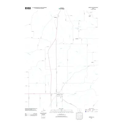
2013 Map of Moravia
USGS Topo · Published 2013About this map
Moravia serves as the primary hub of this southern Iowa landscape, situated at the intersection of local routes like W Church St and N Brandon Ave. The topography is defined by an intricate drainage system including the winding course of Soap Cr and Mormon Cr to the south, while Coal Cr and S Avery Cr drain the northern reaches. Small agricultural settlements and rural junctions like Selection, Hocking, and Foster are scattered across the quadrangle, connected by a strictly gridded network of county roads. The northern edge of the map features the Albia Municipal Airport, illustrating the modern infrastructure that overlays this traditional farming region. This survey captures the rural character of the area where intermittent waterways like Inghram Br and Kinser Cr dictate the placement of farms and homesteads.
Find a feature on this map
72 named features on this map. Tap any name to fly to it.
Don’t see what you’re looking for? This feature index may not catch every label — zoom into the map to look around manually.
Map Details
Editions of this 2013 Moravia Map
This is the sole edition of this map. No revisions or reprints were ever made.
Other maps of this area

1929 · Albia
USGS Topo · 1:62,500

1939 · Mystic
USGS Topo · 1:62,500

1942 · Mystic
USGS Topo · 1:62,500

1954 · Centerville
USGS Topo · 1:250,000

1954 · Des Moines
USGS Topo · 1:250,000

1956 · Des Moines
USGS Topo · 1:250,000

1957 · Des Moines
USGS Topo · 1:250,000

1957 · Centerville
USGS Topo · 1:250,000

1958 · Centerville
USGS Topo · 1:250,000

1966 · Hiattsville
USGS Topo · 1:24,000