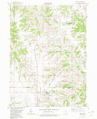
1982 Map of Moravia
USGS Topo · Published 1983About this map
Moravia serves as the primary hub of this southern Iowa landscape during the early 1980s, situated at the junction of the Norfolk and Western and the Chicago Milwaukee St Paul and Pacific railroads. The topography is defined by the drainage networks of Coal Creek and Soap Creek, which carve through the townships of Troy and Monroe. This map is particularly valuable for genealogical research, documenting numerous rural burial grounds such as Hillcrest Cem, Enix Cem, and Mt Pleasant Cem. The presence of the Cottonwood Pits State Game Management Area in the northeast and small settlements like Foster and Hocking illustrate a transition from earlier industrial or agricultural centers to managed natural spaces. The detailed mapping of section lines and township boundaries across both Monroe and Appanoose counties provides a clear framework for tracing historical land ownership.
Find a feature on this map
29 named features on this map. Tap any name to fly to it.
Don’t see what you’re looking for? This feature index may not catch every label — zoom into the map to look around manually.
Map Details
Editions of this 1982 Moravia Map
This is the sole edition of this map. No revisions or reprints were ever made.
Other maps of this area

1929 · Albia
USGS Topo · 1:62,500

1939 · Mystic
USGS Topo · 1:62,500

1942 · Mystic
USGS Topo · 1:62,500

1954 · Centerville
USGS Topo · 1:250,000

1954 · Des Moines
USGS Topo · 1:250,000

1956 · Des Moines
USGS Topo · 1:250,000

1957 · Des Moines
USGS Topo · 1:250,000

1957 · Centerville
USGS Topo · 1:250,000

1958 · Centerville
USGS Topo · 1:250,000

1966 · Hiattsville
USGS Topo · 1:24,000