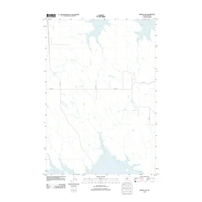
2012 Map of Moreau NW
USGS Topo · Published 2012About this map
Lake Oahe dominates the northern and southern margins of this Corson County landscape, illustrating the vast reach of the Missouri River's reservoir system into the drainage basins of north-central South Dakota. This 2012 survey captures a transition zone where the high prairie is dissected by numerous seasonal watercourses, including Timber Cr and Le Beau Cr, which carve through the terrain toward the main body of the lake. The road network is sparse, defined primarily by local routes like Co HWY-14 and Co HWY-12, reflecting the low-density settlement pattern characteristic of the region. The map provides a clear view of how topographic features such as Chicken Cr and Deadman Cr influence the placement of rural infrastructure and agricultural boundaries in this expansive riverine environment.
Find a feature on this map
12 named features on this map. Tap any name to fly to it.
Don’t see what you’re looking for? This feature index may not catch every label — zoom into the map to look around manually.
Map Details
Editions of this 2012 Moreau NW Map
This is the sole edition of this map. No revisions or reprints were ever made.
Other maps of this area

1951 · Promise
USGS Topo · 1:24,000

1953 · McIntosh
USGS Topo · 1:250,000

1956 · Wakpala SE
USGS Topo · 1:24,000

1958 · McIntosh
USGS Topo · 1:250,000

1967 · Glenham
USGS Topo · 1:24,000

1967 · Mobridge
USGS Topo · 1:24,000

1968 · Moreau NW
USGS Topo · 1:24,000

1968 · Moreau NE
USGS Topo · 1:24,000

1968 · Moreau
USGS Topo · 1:24,000

1968 · Moreau SE
USGS Topo · 1:24,000