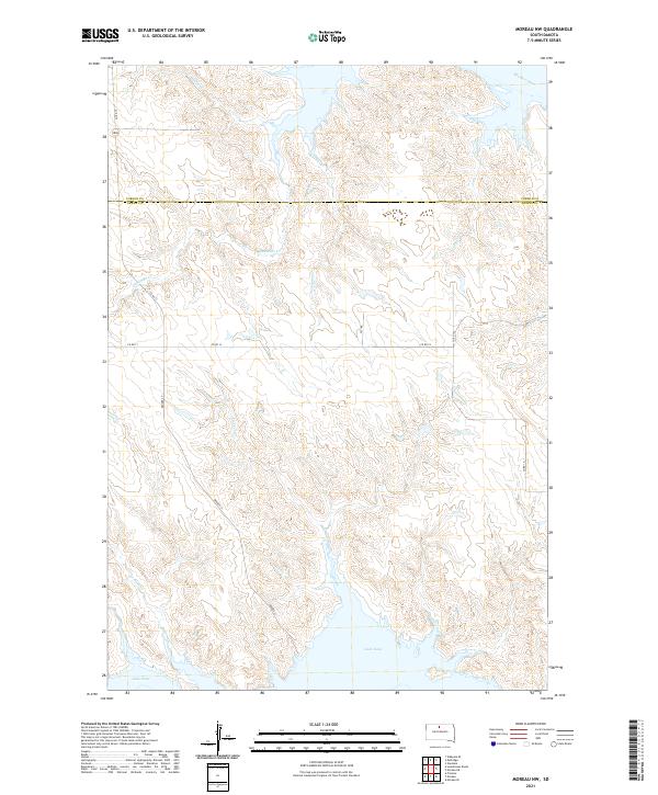
2021 Map of Moreau NW
USGS Topo · Published 2021About this map
The Missouri River and the sprawling northern reaches of Lake Oahe dominate this landscape on the border of Corson and Dewey counties. The terrain is defined by a dense network of drainage coulees and creeks that feed into the reservoir system, including Deadman Cr, Thompson Cr, and Timber Cr. This area represents the high plains of the Cheyenne River Reservation, where the topography is shaped by the significant water management projects of the mid-20th century that transformed the Missouri River valley into a series of massive reservoirs. Local transportation is facilitated by a grid of rural routes such as Co RD 14 and Bender St, which navigate the dissected uplands between the creek beds. The map provides a clear view of the complex shoreline and the numerous inlets formed by submerged tributaries like Chicken Cr and Le Beau Cr.
Find a feature on this map
21 named features on this map. Tap any name to fly to it.
Don’t see what you’re looking for? This feature index may not catch every label — zoom into the map to look around manually.
Map Details
Editions of this 2021 Moreau NW Map
This is the sole edition of this map. No revisions or reprints were ever made.
Other maps of this area

1951 · Promise
USGS Topo · 1:24,000

1953 · McIntosh
USGS Topo · 1:250,000

1956 · Wakpala SE
USGS Topo · 1:24,000

1958 · McIntosh
USGS Topo · 1:250,000

1967 · Glenham
USGS Topo · 1:24,000

1967 · Mobridge
USGS Topo · 1:24,000

1968 · Moreau NW
USGS Topo · 1:24,000

1968 · Moreau NE
USGS Topo · 1:24,000

1968 · Moreau
USGS Topo · 1:24,000

1968 · Moreau SE
USGS Topo · 1:24,000