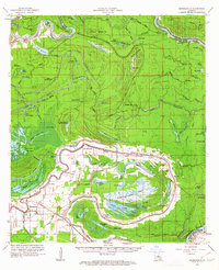
1962 Map of Moreauville
USGS Topo · Published 1963About this map
The alluvial landscape of Avoyelles Parish is defined here by the intricate meanders of the Atchafalaya River and Old River, where flood control and drainage dictate the pattern of human settlement. Communities such as Moreauville, Bordelonville, and Hamburg follow the natural levees and ridges, connected by the Kansas City Southern railroad. The interior is dominated by the Pomme De Terre Swamp and Sutton Ridge, a complex wetland environment filled with smaller water bodies like Horseshoe Lake and Lake Patasa.
Find a feature on this map
110 named features on this map. Tap any name to fly to it.
Don’t see what you’re looking for? This feature index may not catch every label — zoom into the map to look around manually.
Map Details
Editions of this 1962 Moreauville Map
2 editions found
Other maps of this area

1935 · Tooleys
USGS Topo · 1:62,500

1939 · Artonish
USGS Topo · 1:62,500

1939 · Deer Park
USGS Topo · 1:62,500

1940 · Marksville
USGS Topo · 1:62,500

1941 · Voorhies
USGS Topo · 1:62,500

1941 · Buckeye
USGS Topo · 1:62,500

1941 · Batchelor
USGS Topo · 1:62,500

1941 · Tooleys
USGS Topo · 1:62,500

1948 · Bunkie
USGS Topo · 1:62,500

1952 · Lake Charles
USGS Topo · 1:250,000