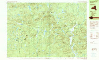
1990 Map of Morehouse Mountain
USGS Topo · Published 1990About this map
Adirondack Park dominates this terrain, where the convergence of Hamilton, Fulton, and Herkimer counties meets. The landscape is characterized by a dense network of water features and high peaks, including Morehouse Mountain and Dead Horse Mountain. Scattered settlements such as Powley Place and Oregon appear alongside isolated landmarks like Clockmill Corners, suggesting a history of small-scale mountain habitation and resource extraction. The presence of Big Goldmine Hill and Little Goldmine Hill points to prospecting efforts in these uplands, while numerous lakes like Christian Lake and Trout Lake are connected by a web of outlets and small streams. This 1990 provisional study captures the area's intricate drainage patterns, from the Piseco Outlet to the various 'vlys' and ponds that fill the basins between the Adirondack summits.
Find a feature on this map
99 named features on this map. Tap any name to fly to it.
Don’t see what you’re looking for? This feature index may not catch every label — zoom into the map to look around manually.
Map Details
Editions of this 1990 Morehouse Mountain Map
This is the sole edition of this map. No revisions or reprints were ever made.
Other maps of this area

1900 · Little Falls
USGS Topo · 1:62,500

1900 · Wilmurt
USGS Topo · 1:62,500

1901 · Lassellsville
USGS Topo · 1:62,500

1902 · Wilmurt
USGS Topo · 1:62,500

1903 · Gloversville
USGS Topo · 1:62,500

1903 · Lassellsville
USGS Topo · 1:62,500

1903 · Little Falls
USGS Topo · 1:62,500

1904 · Piseco Lake
USGS Topo · 1:62,500

1906 · Piseco Lake
USGS Topo · 1:62,500

1907 · Lake Pleasant
USGS Topo · 1:62,500