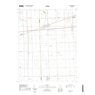
2017 Map of Morehouse
USGS Topo · Published 2017About this map
Morehouse serves as the central hub of this Mississippi Embayment landscape, where the confluence of Scott, Stoddard, and New Madrid counties meets a complex network of waterways. The terrain is defined by its drainage history, with the Little River and Upper Castor River winding through agricultural land punctuated by standing water bodies like King Lake and Whitten Lake. The grid of county roads and state highways connects several small rural settlements, including Canalou to the south and Buffington to the west. This 2017 survey reflects the persistent drainage infrastructure of the Missouri Bootheel, evidenced by features such as the Otter Slough Ditch, which manage the low-lying alluvial plain to support the region's intensive farming. Smaller localities like Delmo, Baker, and Browns dot the intersections, marking the enduring community structure of this tri-county border region.
Find a feature on this map
68 named features on this map. Tap any name to fly to it.
Don’t see what you’re looking for? This feature index may not catch every label — zoom into the map to look around manually.
Map Details
Editions of this 2017 Morehouse Map
This is the sole edition of this map. No revisions or reprints were ever made.
Other maps of this area

1931 · Sikeston
USGS Topo · 1:62,500

1934 · Bloomfield
USGS Topo · 1:62,500

1934 · Sikeston
USGS Topo · 1:62,500

1939 · Bloomfield
USGS Topo · 1:62,500

1939 · Sikeston
USGS Topo · 1:62,500

1939 · New Madrid
USGS Topo · 1:62,500

1940 · Malden
USGS Topo · 1:62,500

1949 · Bloomfield
USGS Topo · 1:62,500

1954 · New Madrid
USGS Topo · 1:62,500

1956 · Malden
USGS Topo · 1:62,500