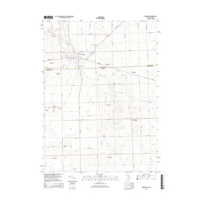
2014 Map of Morenci
USGS Topo · Published 2014About this map
Morenci sits at the northern edge of this map, just above the Michigan Ohio state line in Lenawee County. The town layout is clearly defined by residential streets like E Main St and N Summit St, with Oak Grove Cem situated to the north. South of the border, the landscape in Fulton County, Ohio, transitions into a grid of agricultural land and rural crossroads. The topography is shaped by the meandering courses of Bean Cr and Old Bean Cr, which drain the surrounding plains. Small rural communities and historic points such as Denson, Oakshade, and Thelma serve as local landmarks alongside Rose Cem and Butler Cem. The presence of the Hochstetler Airport west of Morenci indicates a blend of traditional farming infrastructure and modern light aviation facilities serving this border region.
Find a feature on this map
67 named features on this map. Tap any name to fly to it.
Don’t see what you’re looking for? This feature index may not catch every label — zoom into the map to look around manually.
Map Details
Editions of this 2014 Morenci Map
This is the sole edition of this map. No revisions or reprints were ever made.
Other maps of this area

1911 · Wauseon
USGS Topo · 1:62,500

1913 · Wauseon
USGS Topo · 1:62,500

1913 · Alvordton
USGS Topo · 1:62,500

1943 · Wauseon
USGS Topo · 1:62,500

1944 · Alvordton
USGS Topo · 1:62,500

1953 · Fort Wayne
USGS Topo · 1:250,000

1956 · Fort Wayne
USGS Topo · 1:250,000

1959 · Archbold
USGS Topo · 1:24,000
1960 · Wauseon
USGS Topo · 1:24,000

1960 · Morenci
USGS Topo · 1:24,000