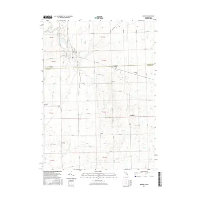
2017 Map of Morenci
USGS Topo · Published 2017About this map
Morenci serves as the primary hub in this borderland landscape where the Michigan Ohio state line divides Lenawee Co Fulton Co. The region is defined by a dense network of watercourses and agricultural drainage, including the winding Bean Cr and the southern headwaters of Bad Cr. Smaller settlements such as Oakshade, Denson, and Thelma appear as quiet rural junctions, linked by a grid of section-line roads like Us Rte 20 and State Line RD.
Find a feature on this map
35 named features on this map. Tap any name to fly to it.
Don’t see what you’re looking for? This feature index may not catch every label — zoom into the map to look around manually.
Map Details
Editions of this 2017 Morenci Map
This is the sole edition of this map. No revisions or reprints were ever made.
Other maps of this area

1911 · Wauseon
USGS Topo · 1:62,500

1913 · Wauseon
USGS Topo · 1:62,500

1913 · Alvordton
USGS Topo · 1:62,500

1943 · Wauseon
USGS Topo · 1:62,500

1944 · Alvordton
USGS Topo · 1:62,500

1953 · Fort Wayne
USGS Topo · 1:250,000

1956 · Fort Wayne
USGS Topo · 1:250,000

1959 · Archbold
USGS Topo · 1:24,000
1960 · Wauseon
USGS Topo · 1:24,000

1960 · Morenci
USGS Topo · 1:24,000