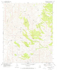
1969 Map of Morgan Butte
USGS Topo · Published 1972About this map
The Wickenburg Mountains define this desert terrain north of Wickenburg, revealing an extensive network of mining operations during the late 1960s. Mining activity is the primary human footprint here, with operations such as the Monte Cristo Mine, Gold Bar Mine, and Abe Lincoln Mine tucked into the steep canyons and gulches. The landscape is carved by seasonal drainages including the Hassayampa River and San Domingo Wash, where a sparse infrastructure of jeep trails and the Constellation Road provide the only access to remote claims like the King Solomon Mine. Researchers will find numerous USLM markers, including Uslm 1623, indicating the density of patented mineral claims in the area. Small pockets of habitation, such as Roberts Camp, appear alongside landmarks like Morgan Butte, illustrating the precarious balance between settlement and the demanding environment of the Arizona high desert.
Find a feature on this map
52 named features on this map. Tap any name to fly to it.
Don’t see what you’re looking for? This feature index may not catch every label — zoom into the map to look around manually.
Map Details
Editions of this 1969 Morgan Butte Map
3 editions found
Other maps of this area

1887 · Prescott
USGS Topo · 1:250,000

1892 · Prescott
USGS Topo · 1:250,000

1903 · Bradshaw Mountains
USGS Topo · 1:125,000

1903 · Congress
USGS Topo · 1:125,000

1904 · Congress
USGS Topo · 1:125,000

1947 · Crown King
USGS Topo · 1:62,500

1947 · Wagoner
USGS Topo · 1:62,500

1948 · Crown King
USGS Topo · 1:63,360

1948 · Wagoner
USGS Topo · 1:63,360

1950 · Wagoner
USGS Topo · 1:62,500