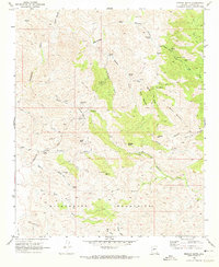
1969 Map of Morgan Butte
USGS Topo · Published 1973About this map
Mining operations dominate this arid landscape within the Wickenburg Mountains, where the 1969 terrain is marked by numerous historic claims and specialized camps. Prospectors and genealogists can trace the location of the Monte Cristo Mine, King Solomon Mine, and the Gold Bar Mine, among several others. These industrial sites are linked by a network of primitive roads, including Constellation Road and various jeep trails that navigate the drainage systems of the Hassayampa River and Buckskin River.
Find a feature on this map
52 named features on this map. Tap any name to fly to it.
Don’t see what you’re looking for? This feature index may not catch every label — zoom into the map to look around manually.
Map Details
Editions of this 1969 Morgan Butte Map
3 editions found
Other maps of this area

1887 · Prescott
USGS Topo · 1:250,000

1892 · Prescott
USGS Topo · 1:250,000

1903 · Bradshaw Mountains
USGS Topo · 1:125,000

1903 · Congress
USGS Topo · 1:125,000

1904 · Congress
USGS Topo · 1:125,000

1947 · Crown King
USGS Topo · 1:62,500

1947 · Wagoner
USGS Topo · 1:62,500

1948 · Crown King
USGS Topo · 1:63,360

1948 · Wagoner
USGS Topo · 1:63,360

1950 · Wagoner
USGS Topo · 1:62,500