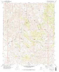
1969 Map of Morgan Butte
USGS Topo · Published 1972About this map
Mining operations and remote claims dominate this arid landscape of Yavapai County during the late 1960s. The topography is defined by the Hassayampa River and Buckskin River cutting through a network of peaks, including Morgan Butte and Swallow Mountain. A high concentration of historic lode and placer mining sites are scattered throughout the hills, ranging from the well-known Monte Cristo Mine and Gold Bar Mine to smaller prospects near Crown Point Gulch. Local transportation relies heavily on a complex system of jeep trails and pack trails that connect isolated camps like Roberts Camp to the more established Constellation Road. Evidence of early surveying and mineral claims is preserved through several Mineral Survey landmarks such as Uslm 2489 and Uslm 1477. The presence of a cemetery near Solomon Gulch suggests a once-permanent community associated with the King Solomon Mine.
Find a feature on this map
53 named features on this map. Tap any name to fly to it.
Don’t see what you’re looking for? This feature index may not catch every label — zoom into the map to look around manually.
Map Details
Editions of this 1969 Morgan Butte Map
3 editions found
Other maps of this area

1887 · Prescott
USGS Topo · 1:250,000

1892 · Prescott
USGS Topo · 1:250,000

1903 · Bradshaw Mountains
USGS Topo · 1:125,000

1903 · Congress
USGS Topo · 1:125,000

1904 · Congress
USGS Topo · 1:125,000

1947 · Crown King
USGS Topo · 1:62,500

1947 · Wagoner
USGS Topo · 1:62,500

1948 · Crown King
USGS Topo · 1:63,360

1948 · Wagoner
USGS Topo · 1:63,360

1950 · Wagoner
USGS Topo · 1:62,500