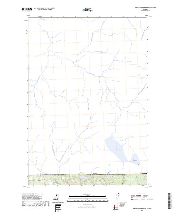
2024 Map of Morgan Center OE N
USGS Topo · Published 2024About this map
The international border between Vermont and Quebec defines this northern landscape, where water drainage patterns reveal the trans-border nature of the local geography. Significant water bodies such as Lac Lyster and Petit Lac Baldwin dominate the northeastern terrain, while a network of streams including Rivière Niger and Cours d'eau Ménard flow northward into Canadian territory. On the United States side, the landscape is more densely marked by transit routes near the edge of the quadrangle. Roads such as Holland Pond Rd and Line Farm Rd provide access to the area's interior, alongside recreation-focused paths like the 105A Trl. The inclusion of Beaver Pond and Holland Brook highlights the wetland environments and hydrological systems that bridge Orleans and Essex counties at the very edge of the American border.
Find a feature on this map
20 named features on this map. Tap any name to fly to it.
Don’t see what you’re looking for? This feature index may not catch every label — zoom into the map to look around manually.
Map Details
Editions of this 2024 Morgan Center OE N Map
This is the sole edition of this map. No revisions or reprints were ever made.
Other maps of this area

1919 · Lake Memphremagog
USGS Topo · 1:62,500

1920 · Derby
USGS Topo · 1:62,500

1923 · Lake Memphremagog
USGS Topo · 1:48,000

1924 · Island Pond
USGS Topo · 1:48,000

1925 · Memphremagog
USGS Topo · 1:62,500

1926 · Island Pond
USGS Topo · 1:62,500

1949 · Jackman
USGS Topo · 1:250,000

1950 · Lake Champlain
USGS Topo · 1:250,000

1950 · Lewiston
USGS Topo · 1:250,000

1953 · Island Pond
USGS Topo · 1:62,500