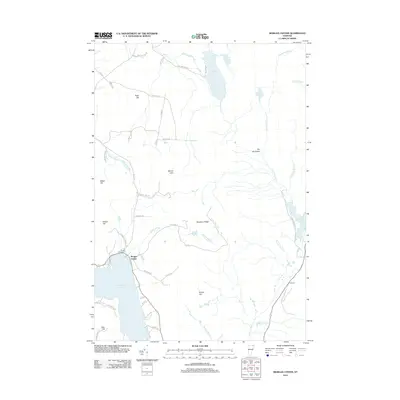
2012 Map of Morgan Center
USGS Topo · Published 2012About this map
Seymour Lake dominates the southwestern corner of this Vermont landscape, where the village of Morgan Center sits along its northern shore. This 2012 survey illustrates a region defined by its hydrology and upland relief, with Beechnut Ridge and Round Top rising above a complex network of waterways including the Pherrins River and Sucker Brook. Local history is anchored at the Morgan Center Cem, while the eastern portion of the sheet shows the transition toward more isolated terrain near Summit. The map detail captures the rural road network, from Moulton Hill Rd in the north to the residential clusters along Elliott Acres Rd, providing a clear record of the area's contemporary land use and settlement patterns near Holland Pond.
Find a feature on this map
55 named features on this map. Tap any name to fly to it.
Don’t see what you’re looking for? This feature index may not catch every label — zoom into the map to look around manually.
Map Details
Editions of this 2012 Morgan Center Map
This is the sole edition of this map. No revisions or reprints were ever made.
Other maps of this area

1919 · Lake Memphremagog
USGS Topo · 1:62,500

1920 · Derby
USGS Topo · 1:62,500

1923 · Lake Memphremagog
USGS Topo · 1:48,000

1924 · Island Pond
USGS Topo · 1:48,000

1925 · Memphremagog
USGS Topo · 1:62,500

1926 · Island Pond
USGS Topo · 1:62,500

1949 · Jackman
USGS Topo · 1:250,000

1950 · Lake Champlain
USGS Topo · 1:250,000

1950 · Lewiston
USGS Topo · 1:250,000

1953 · Island Pond
USGS Topo · 1:62,500