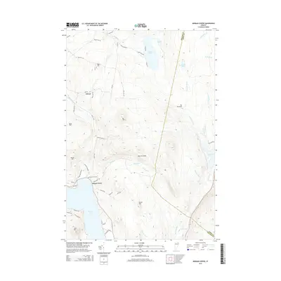
2015 Map of Morgan Center
USGS Topo · Published 2015About this map
Morgan Center sits along the northern shore of Seymour Lake, serving as a central point in this landscape of water and high ridges. The area is defined by significant elevation changes, with peaks like Mt John and Beechnut Ridge overlooking a series of glacial ponds including Holland Pond and Norton Pond. This 2015 survey shows a rural residential pattern concentrated along the lakefronts, such as Elliott Acres, while the interior remains dominated by drainage networks like Sucker Brook and the Pherrins River.
Find a feature on this map
56 named features on this map. Tap any name to fly to it.
Don’t see what you’re looking for? This feature index may not catch every label — zoom into the map to look around manually.
Map Details
Editions of this 2015 Morgan Center Map
This is the sole edition of this map. No revisions or reprints were ever made.
Other maps of this area

1919 · Lake Memphremagog
USGS Topo · 1:62,500

1920 · Derby
USGS Topo · 1:62,500

1923 · Lake Memphremagog
USGS Topo · 1:48,000

1924 · Island Pond
USGS Topo · 1:48,000

1925 · Memphremagog
USGS Topo · 1:62,500

1926 · Island Pond
USGS Topo · 1:62,500

1949 · Jackman
USGS Topo · 1:250,000

1950 · Lake Champlain
USGS Topo · 1:250,000

1950 · Lewiston
USGS Topo · 1:250,000

1953 · Island Pond
USGS Topo · 1:62,500