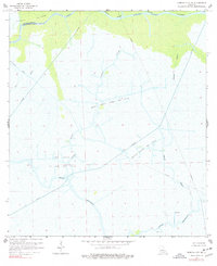
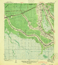
1966 Map of Morgan City SE
USGS Topo · Published 1977About this map
Avoca Island and the surrounding marshlands of St. Mary and Terrebonne Parishes dominate this mid-century coastal landscape. The terrain is a complex network of wetlands defined by the Intracoastal Waterway and winding natural channels like Bayou Chene, Bayou Black, and Bayou Cocodrie. The 1960s economy of the region is clearly visible through the extensive energy infrastructure, including the North Turtle Bayou Gas Field and a dense network of pipelines that cut across the marsh. Navigation and industry are the primary human imprints here, with the Burke Canal and various drill holes highlighting the extraction activities that transformed the swamp. Waterways such as Turtle Bayou and Bayou Penchant serve as the principal landmarks in a region where solid land is scarce and water dictates the pattern of development.
Find a feature on this map
18 named features on this map. Tap any name to fly to it.
Don’t see what you’re looking for? This feature index may not catch every label — zoom into the map to look around manually.
Map Details
Editions of this 1966 Morgan City SE Map
4 editions found
Other maps of this area

1892 · Gibson
USGS Topo · 1:62,500

1894 · Bayou De Large
USGS Topo · 1:62,500

1897 · Gibson
USGS Topo · 1:62,500

1932 · Lake Decade
USGS Topo · 1:62,500

1935 · Morgan City
USGS Topo · 1:62,500

1935 · Lake Penchant
USGS Topo · 1:31,680

1939 · Gibson
USGS Topo · 1:62,500

1940 · Bayou Du Large
USGS Topo · 1:62,500

1941 · Bayou Du Large
USGS Topo · 1:62,500
1941 · Gibson
USGS Topo · 1:62,500