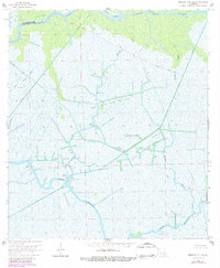
1966 Map of Morgan City SE
USGS Topo · Published 1984About this map
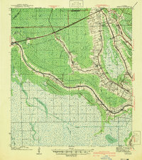
St Mary Parish and Terrebonne Parish meet in this marshland landscape dominated by an intricate network of waterways and industrial infrastructure. The northern edge is defined by the Intracoastal Waterway and the broad Avoca Island, while the interior is a complex weave of natural bayous and man-made features. The extraction economy of the mid-20th century is evident through the sprawling North Turtle Bayou Gas Field and the Turtle Bayou Gas Field, connected by a geometric grid of canals and pipelines. This survey reveals how the petroleum industry reshaped the hydrology of the wetlands, cutting straight channels like the Burke Canal through the winding paths of Bayou Penchant and Kent Bayou. The presence of numerous drill holes throughout the marsh reflects the intensive subterranean exploration of the era.
Find a feature on this map
19 named features on this map. Tap any name to fly to it.
Don’t see what you’re looking for? This feature index may not catch every label — zoom into the map to look around manually.
Map Details
Editions of this 1966 Morgan City SE Map
4 editions found
Other maps of this area

1892 · Gibson
USGS Topo · 1:62,500

1894 · Bayou De Large
USGS Topo · 1:62,500

1897 · Gibson
USGS Topo · 1:62,500

1932 · Lake Decade
USGS Topo · 1:62,500

1935 · Morgan City
USGS Topo · 1:62,500

1935 · Lake Penchant
USGS Topo · 1:31,680

1939 · Gibson
USGS Topo · 1:62,500

1940 · Bayou Du Large
USGS Topo · 1:62,500

1941 · Bayou Du Large
USGS Topo · 1:62,500
1941 · Gibson
USGS Topo · 1:62,500