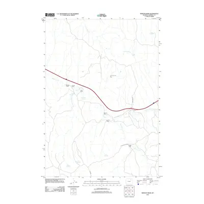
2012 Map of Morgan Draw
USGS Topo · Published 2012About this map
The Dead Horse Creek Oil Field centers this landscape in Campbell County, illustrating the industrial footprint of energy extraction in the Powder River Basin. The terrain is defined by a complex network of drainage systems, including Dead Horse Cr and its northern prong, which carve out numerous named draws such as Morgan Draw, Punkie Draw, and John Draw.
Find a feature on this map
19 named features on this map. Tap any name to fly to it.
Don’t see what you’re looking for? This feature index may not catch every label — zoom into the map to look around manually.
Map Details
Editions of this 2012 Morgan Draw Map
This is the sole edition of this map. No revisions or reprints were ever made.
Other maps of this area

1954 · Gillette
USGS Topo · 1:250,000

1955 · Sheridan
USGS Topo · 1:250,000

1955 · Gillette
USGS Topo · 1:250,000

1958 · Gillette
USGS Topo · 1:250,000

1958 · Sheridan
USGS Topo · 1:250,000

1962 · Gillette
USGS Topo · 1:250,000

1962 · Sheridan
USGS Topo · 1:250,000
1971 · Double Tanks
USGS Topo · 1:24,000
1971 · Scott Dam
USGS Topo · 1:24,000
1971 · Bogie Draw
USGS Topo · 1:24,000