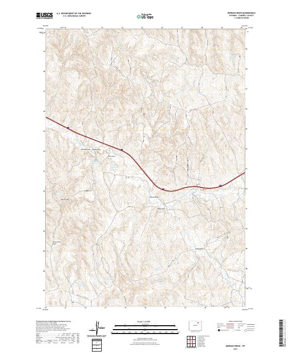
2021 Map of Morgan Draw
USGS Topo · Published 2021About this map
Arid drainage systems and livestock-water infrastructure characterize this portion of Campbell County, where the landscape is defined by a dense network of intermittent draws and creeks. The hydrology centers on the Dead Horse Cr and its various branches, including the N Prong Dead Horse Cr and S Prong Barber Cr. Ranching-era land use is evident in the numerous small catchments like Kirby Reservoir, Karen Reservoir, and Morgan Reservoir. Named topographical features such as Morgan Draw, Punkie Draw, and Government Draw suggest a long history of local geographic identification by homesteaders and cattlemen. The area is intersected by Interstate 90 and established rural routes like Barber Creek Rd and Buffalo Cut Across Rd, which facilitate movement through the dissected terrain of the Powder River Basin.
Find a feature on this map
25 named features on this map. Tap any name to fly to it.
Don’t see what you’re looking for? This feature index may not catch every label — zoom into the map to look around manually.
Map Details
Editions of this 2021 Morgan Draw Map
This is the sole edition of this map. No revisions or reprints were ever made.
Other maps of this area

1954 · Gillette
USGS Topo · 1:250,000

1955 · Sheridan
USGS Topo · 1:250,000

1955 · Gillette
USGS Topo · 1:250,000

1958 · Gillette
USGS Topo · 1:250,000

1958 · Sheridan
USGS Topo · 1:250,000

1962 · Gillette
USGS Topo · 1:250,000

1962 · Sheridan
USGS Topo · 1:250,000
1971 · Double Tanks
USGS Topo · 1:24,000
1971 · Scott Dam
USGS Topo · 1:24,000
1971 · Bogie Draw
USGS Topo · 1:24,000