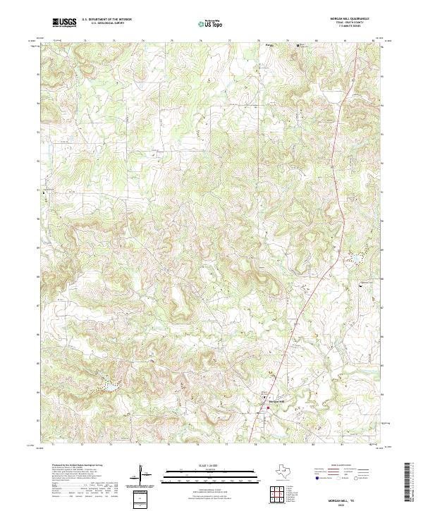
2022 Map of Morgan Mill
USGS Topo · Published 2022About this map
Morgan Mill serves as the primary hub of this Erath County landscape, situated near the confluence of the Paluxy River and N Paluxy River. The area is defined by a dense network of seasonal drainages, including Germany Cr, Counts Cr, and Bee Dee Cr, which carve through the terrain and dictate the winding paths of county roads. Further north, the small settlement of Patillo sits near the northern boundary, reflecting the dispersed rural development characteristic of the region.
Find a feature on this map
57 named features on this map. Tap any name to fly to it.
Don’t see what you’re looking for? This feature index may not catch every label — zoom into the map to look around manually.
Map Details
Editions of this 2022 Morgan Mill Map
This is the sole edition of this map. No revisions or reprints were ever made.
Other maps of this area

1890 · Stephenville
USGS Topo · 1:125,000

1891 · Palo Pinto
USGS Topo · 1:125,000

1918 · Palo Pinto
USGS Topo · 1:125,000

1920 · Stephenville
USGS Topo · 1:125,000

1931 · Santo
USGS Topo · 1:62,500

1954 · Abilene
USGS Topo · 1:250,000

1958 · Abilene
USGS Topo · 1:250,000
1959 · Lipan
USGS Topo · 1:62,500

1959 · Gordon
USGS Topo · 1:62,500

1961 · Knob Hill
USGS Topo · 1:24,000