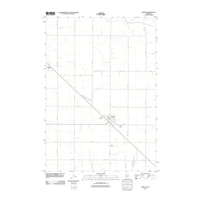
2010 Map of Morgan
USGS Topo · Published 2010About this map
The settlement of Morgan sits at the junction of several county highways in this Redwood County landscape, defined by a highly organized grid of rural roads and agricultural water management. The community is anchored by the Morgan Post Office and multiple burial grounds including Saint Michael Cemetery, Saint Johns Cemetery, and Morgan Cemetery, providing significant points of interest for genealogical research. To the northwest, the small locality of Gilfillan marks another point of early regional development. The natural drainage of Wabasha Creek and Spring Creek is augmented by an extensive system of engineered waterways such as County Ditch Number One Hundred Nine and Judicial Ditch Number Twenty-nine, illustrating the transformation of the prairie into a productive agricultural engine by the early 21st century.
Find a feature on this map
30 named features on this map. Tap any name to fly to it.
Don’t see what you’re looking for? This feature index may not catch every label — zoom into the map to look around manually.
Map Details
Editions of this 2010 Morgan Map
This is the sole edition of this map. No revisions or reprints were ever made.
Other maps of this area

1952 · Morton
USGS Topo · 1:62,500

1952 · Redwood Falls
USGS Topo · 1:62,500

1953 · Morgan
USGS Topo · 1:62,500

1953 · New Ulm
USGS Topo · 1:250,000

1957 · New Ulm
USGS Topo · 1:250,000

1958 · New Ulm
USGS Topo · 1:250,000

1967 · New Ulm
USGS Topo · 1:250,000

1967 · Clements
USGS Topo · 1:24,000

1967 · Clements SE
USGS Topo · 1:24,000
1982 · Morgan NE
USGS Topo · 1:24,000