
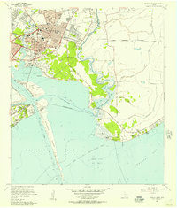
1956 Map of Morgans Point
USGS Topo · Published 1977About this map
Baytown dominates the northern landscape of this coastal survey, where the industrial expansion of the mid-20th century meets the intricate wetlands of the Texas Gulf Coast. The map documents a complex infrastructure of Southern Pacific and U S Steel Corp Railroad lines serving the region's energy sector, specifically the Jergins Oil Field and the underwater Cedar Point Oil Field. Between the urban core and the open waters of Galveston Bay, a network of tidal features like Ash Lake and Negrohead Lake persists alongside dredging projects like the Cedar Bayou Channel. Social and educational life is reflected in the numerous local institutions, including the G W Carver Sch, Robert E Lee High Sch, and recreational sites like Camp Sterling (YMCA). This 1969 revision highlights the growth of Morgans Point and the strategic importance of the Houston Ship Channel as it cuts past Hogg Island.
Find a feature on this map
60 named features on this map. Tap any name to fly to it.
Don’t see what you’re looking for? This feature index may not catch every label — zoom into the map to look around manually.
Map Details
Editions of this 1956 Morgans Point Map
Historical Maps of Baytown Through Time
46 maps found

1916 Morgan Point
Chambers County, TX

1919 Morgan Point
Chambers County, TX

1931 Frozen Point
Chambers County, TX

1931 High Island
Chambers County, TX

1932 Clifton By The Sea
Chambers County, TX

1933 Frozen Point
Chambers County, TX

1933 Smith Point
Chambers County, TX

1933 Whites Lake
Chambers County, TX

1943 Clifton By The Sea
Chambers County, TX

1943 Frozen Point
Chambers County, TX

1943 High Island
Chambers County, TX

1943 Lake Stephenson
Chambers County, TX

1943 Morgan Point
Chambers County, TX

1943 Sea Breeze
Chambers County, TX

1943 Smith Point
Chambers County, TX

1943 West of Eagle
Chambers County, TX

1945 Sea Breeze
Chambers County, TX
1956 Morgans Point
Chambers County, TX

1961 Lake Stephenson
Chambers County, TX

1961 Monroe City
Chambers County, TX

1961 Oyster Bayou
Chambers County, TX

1961 Smith Point
Chambers County, TX

1961 Umbrella Point
Chambers County, TX

1962 Frozen Point
Chambers County, TX

1962 High Island
Chambers County, TX

1962 Stanolind Reservoir
Chambers County, TX

1982 Morgans Point
Chambers County, TX

1993 Morgans Point
Chambers County, TX

1993 Smith Point
Chambers County, TX

1994 Frozen Point
Chambers County, TX

1994 High Island
Chambers County, TX

1994 Lake Stephenson
Chambers County, TX

1994 Monroe City
Chambers County, TX

1994 Oyster Bayou
Chambers County, TX

1994 Stanolind Reservoir
Chambers County, TX

1994 Umbrella Point
Chambers County, TX

1995 Morgans Point
Chambers County, TX

2022 Lake Stephenson
Chambers County, TX

2022 Monroe City
Chambers County, TX

2022 Morgans Point
Chambers County, TX

2022 Smith Point
Chambers County, TX

2022 Umbrella Point
Chambers County, TX

2025 Frozen Point
Chambers County, TX

2025 High Island
Chambers County, TX

2025 Oyster Bayou
Chambers County, TX

2025 Stanolind Reservoir
Chambers County, TX