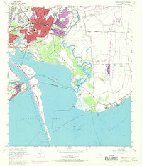
1956 Map of Morgan Point
USGS Topo · Published 1970About this map
Baytown serves as the industrial and residential anchor of this coastal landscape, situated where Goose Creek meets the northern reaches of Galveston Bay. The map reveals a mid-century city in transition, with a dense network of local schools including Robert E Lee High Sch and Horace Mann Sch, alongside the San Jacinto Memorial Hosp. The industrial character of the region is defined by the Houston Ship Channel and the convergence of the Southern Pacific and Missouri Pacific railroads, facilitating the heavy commerce of the nearby Oil Fields.
Find a feature on this map
71 named features on this map. Tap any name to fly to it.
Don’t see what you’re looking for? This feature index may not catch every label — zoom into the map to look around manually.
Map Details
Editions of this 1956 Morgan Point Map
Other maps of this area

1916 · Burnett Bay
USGS Topo · 1:24,000

1916 · Morgan Point
USGS Topo · 1:24,000

1916 · Seabrook
USGS Topo · 1:24,000

1916 · Cedar Bayou
USGS Topo · 1:24,000

1916 · La Porte
USGS Topo · 1:24,000

1919 · Morgan Point
USGS Topo · 1:31,680

1919 · Cedar Bayou
USGS Topo · 1:31,680

1920 · Seabrook
USGS Topo · 1:31,680

1920 · La Porte
USGS Topo · 1:31,680

1920 · Highlands
USGS Topo · 1:31,680