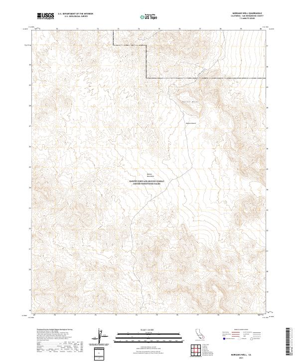
2021 Map of Morgans Well
USGS Topo · Published 2021About this map
The Bullion Mountains dominate this section of the Mojave Desert within San Bernardino County, where the topography transitions from high tablelands to expansive alluvial basins. The presence of Bagdad Chase Rd provides a historical trace of the region's mining heritage, specifically serving as a connector toward the storied gold and copper districts to the north. In this arid landscape, the flat-topped profile of Pacific Mesa stands as a prominent landmark amidst the surrounding complex of peaks and dry washes. The map's surveyed sections, including t6n r7e and t5n r8e, illustrate the expansive nature of these public lands as they appeared in 2021, revealing a landscape largely defined by its natural features and occasional desert roads.
Find a feature on this map
8 named features on this map. Tap any name to fly to it.
Don’t see what you’re looking for? This feature index may not catch every label — zoom into the map to look around manually.
Map Details
Editions of this 2021 Morgans Well Map
This is the sole edition of this map. No revisions or reprints were ever made.
Other maps of this area

1953 · San Bernardino
USGS Topo · 1:250,000

1954 · Hidalgo Mtn
USGS Topo · 1:24,000

1954 · Ludlow SE
USGS Topo · 1:24,000

1955 · Deadman Lake NW
USGS Topo · 1:24,000

1955 · Ludlow
USGS Topo · 1:24,000

1955 · Lavic SE
USGS Topo · 1:24,000

1955 · Morgans Well
USGS Topo · 1:24,000

1955 · Deadman Lake NE
USGS Topo · 1:24,000

1955 · Ash Hill
USGS Topo · 1:24,000

1955 · Lavic Lake
USGS Topo · 1:24,000