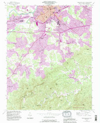
1993 Map of Morganton South
USGS Topo · Published 1996About this map
The Catawba River marks the northern boundary of this landscape, where the urban character of Morganton gives way to the rising elevations of the South Mountains. This 1993 revision highlights the institutional footprint of the region, specifically the sprawling grounds of the State Hospital and the State Sch for the Deaf south of the city center. The transition from Piedmont foothills to the mountain range is punctuated by a network of rural communities and crossroads, including Petersburg, Salem, and Pumpkin Center.
Find a feature on this map
62 named features on this map. Tap any name to fly to it.
Don’t see what you’re looking for? This feature index may not catch every label — zoom into the map to look around manually.
Map Details
Editions of this 1993 Morganton South Map
This is the sole edition of this map. No revisions or reprints were ever made.
Other maps of this area

1905 · Morganton
USGS Topo · 1:125,000

1953 · Charlotte
USGS Topo · 1:250,000

1954 · Charlotte
USGS Topo · 1:250,000

1956 · Valdese
USGS Topo · 1:24,000

1956 · Oak Hill
USGS Topo · 1:24,000

1956 · Benn Knob
USGS Topo · 1:24,000

1956 · Morganton North
USGS Topo · 1:24,000

1956 · Casar
USGS Topo · 1:24,000

1956 · Morganton South
USGS Topo · 1:24,000

1956 · Drexel
USGS Topo · 1:24,000