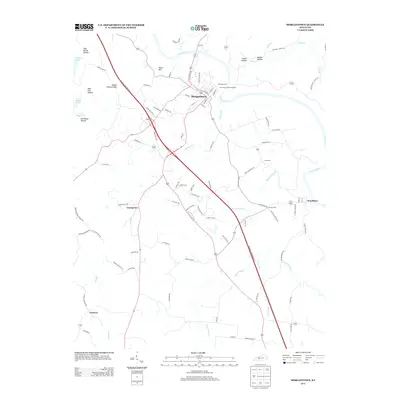
2013 Map of Morgantown
USGS Topo · Published 2013About this map
Morgantown serves as the primary hub of this landscape, situated near the winding Green River and the confluence of major transit routes. The geography is defined by a dense network of watercourses and naming traditions that reflect long-standing local ties, including Hocker Br, Renfrow Cr, and Black Swamp Br. Industrial activity is concentrated south of the town center along Industrial Dr N, while the surrounding countryside maintains a pattern of smaller settlements like Youngtown, Leetown, and Woodbury. Genealogists will find several burial sites noted, from the centrally located Hill Haven Memory Gardens to family-named markers such as Wade Cem, Cook Cem, and Newton Cem. The terrain rises to distinct landmarks like Allens Hill and the uniquely named Hagan Shanty Ridge, while numerous hollows such as Stillhouse Hollow and Deer Lick Hollow suggest the historical character of these Kentucky woodlands.
Find a feature on this map
94 named features on this map. Tap any name to fly to it.
Don’t see what you’re looking for? This feature index may not catch every label — zoom into the map to look around manually.
Map Details
Editions of this 2013 Morgantown Map
This is the sole edition of this map. No revisions or reprints were ever made.
Other maps of this area

1909 · Hartford
USGS Topo · 1:62,500

1911 · Dunmor
USGS Topo · 1:48,000

1914 · Little Muddy
USGS Topo · 1:62,500

1914 · Dunmor
USGS Topo · 1:62,500

1925 · Spring Lick
USGS Topo · 1:62,500

1953 · South Hill
USGS Topo · 1:24,000

1953 · Quality
USGS Topo · 1:24,000

1954 · Evansville
USGS Topo · 1:250,000

1954 · Welchs Creek
USGS Topo · 1:24,000
1954 · Cromwell
USGS Topo · 1:24,000