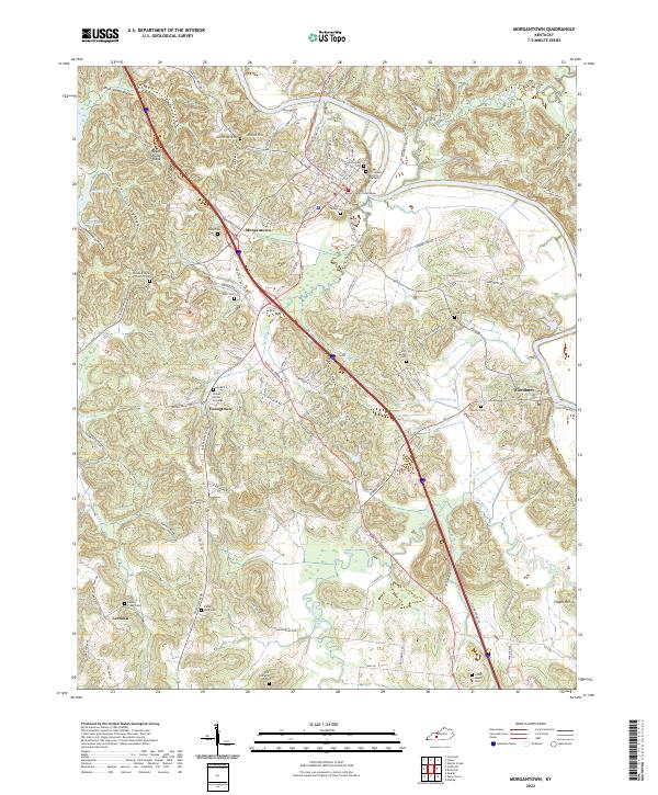
2022 Map of Morgantown
USGS Topo · Published 2022About this map
The Green River carves a winding path through the heart of this landscape, anchoring the historic county seat of Morgantown. This modern survey reveals a dense network of ancestral sites and cemeteries that serve as a testament to generations of settlement in Butler County. From the Butler County Courthouse in the center of town, the terrain ripples outward into distinctive ridges and hollows like Hagan Shanty Ridge and Deer Lick Hollow.
Find a feature on this map
100 named features on this map. Tap any name to fly to it.
Don’t see what you’re looking for? This feature index may not catch every label — zoom into the map to look around manually.
Map Details
Editions of this 2022 Morgantown Map
This is the sole edition of this map. No revisions or reprints were ever made.
Other maps of this area

1909 · Hartford
USGS Topo · 1:62,500

1911 · Dunmor
USGS Topo · 1:48,000

1914 · Little Muddy
USGS Topo · 1:62,500

1914 · Dunmor
USGS Topo · 1:62,500

1925 · Spring Lick
USGS Topo · 1:62,500

1953 · South Hill
USGS Topo · 1:24,000

1953 · Quality
USGS Topo · 1:24,000

1954 · Evansville
USGS Topo · 1:250,000

1954 · Welchs Creek
USGS Topo · 1:24,000
1954 · Cromwell
USGS Topo · 1:24,000