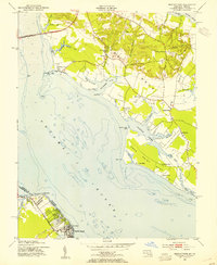
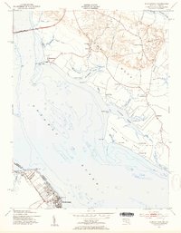
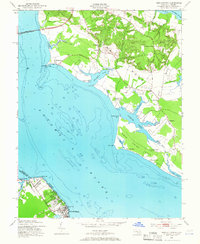
1953 Map of Morgantown
USGS Topo · Published 1954About this map
Potomac River crossings and tidewater peninsulas define this mid-century look at the border between Maryland and Virginia. The Potomac River Bridge connects the Maryland shore at Morgantown to the Virginia side, where the vacation hub of Colonial Beach and the smaller Potomac Beach serve as significant riverfront landmarks. The landscape is deeply carved by tidal inlets and necks, including Swan Point Neck and Cob Neck, showing a mix of established agricultural settlements and maritime influence.
Find a feature on this map
54 named features on this map. Tap any name to fly to it.
Don’t see what you’re looking for? This feature index may not catch every label — zoom into the map to look around manually.
Map Details
Editions of this 1953 Morgantown Map
3 editions found
Other maps of this area

1889 · Fredericksburg
USGS Topo · 1:125,000

1892 · Fredericksburg
USGS Topo · 1:125,000

1892 · Montross
USGS Topo · 1:62,500

1894 · Wicomico
USGS Topo · 1:62,500

1894 · Fredericksburg
USGS Topo · 1:125,000

1895 · Wicomico
USGS Topo · 1:62,500

1895 · Nomini
USGS Topo · 1:125,000

1895 · Montross
USGS Topo · 1:62,500

1898 · Nomini
USGS Topo · 1:125,000

1902 · Wicomico
USGS Topo · 1:62,500