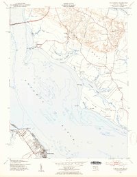
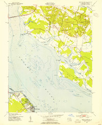
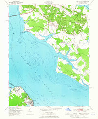
1953 Map of Morgantown
USGS Topo · Published 1954About this map
Colonial Beach and Potomac Beach anchor the Virginia side of this mid-century survey, facing the expansive waters of the Potomac River where it meets the Maryland-Virginia state line. The landscape is dominated by the narrow peninsulas of Cobb Neck and Swan Point Neck, defined by an intricate network of tidal waterways including Cuckold Creek and Neale Sound. These coastal fingers are dotted with small riverine settlements like Banks O'Dee and Woodland Point.
Find a feature on this map
54 named features on this map. Tap any name to fly to it.
Don’t see what you’re looking for? This feature index may not catch every label — zoom into the map to look around manually.
Map Details
Editions of this 1953 Morgantown Map
3 editions found
Other maps of this area

1889 · Fredericksburg
USGS Topo · 1:125,000

1892 · Fredericksburg
USGS Topo · 1:125,000

1892 · Montross
USGS Topo · 1:62,500

1894 · Wicomico
USGS Topo · 1:62,500

1894 · Fredericksburg
USGS Topo · 1:125,000

1895 · Wicomico
USGS Topo · 1:62,500

1895 · Nomini
USGS Topo · 1:125,000

1895 · Montross
USGS Topo · 1:62,500

1898 · Nomini
USGS Topo · 1:125,000

1902 · Wicomico
USGS Topo · 1:62,500