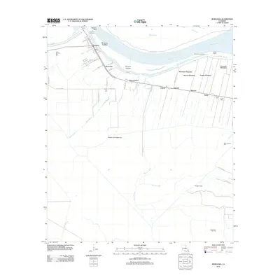
2012 Map of Morganza
USGS Topo · Published 2012About this map
Morganza stands at the heart of this landscape, situated near the dramatic bend of the Mississippi River where the Morganza Crevasse and Morganza Revetment mark the critical intersection of human engineering and river hydrology. This 2012 survey illustrates a landscape defined by its historical agricultural foundations and modern energy extraction, showing a string of named estates including Brunswick Plantation, Stewart Plantation, and Stonewell Plantation along the fertile riverside corridor.
Find a feature on this map
50 named features on this map. Tap any name to fly to it.
Don’t see what you’re looking for? This feature index may not catch every label — zoom into the map to look around manually.
Map Details
Editions of this 2012 Morganza Map
This is the sole edition of this map. No revisions or reprints were ever made.
Other maps of this area

1906 · Bayou Sara
USGS Topo · 1:125,000

1939 · St. Francisville
USGS Topo · 1:62,500

1939 · Fordoche
USGS Topo · 1:62,500

1941 · Batchelor
USGS Topo · 1:62,500

1953 · New Roads
USGS Topo · 1:24,000

1954 · Fordoche
USGS Topo · 1:24,000

1954 · Erwinville
USGS Topo · 1:24,000

1954 · Baton Rouge
USGS Topo · 1:250,000

1955 · Fordoche
USGS Topo · 1:62,500

1955 · Batchelor
USGS Topo · 1:62,500