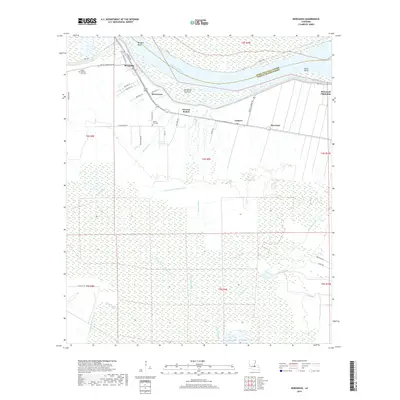
2018 Map of Morganza
USGS Topo · Published 2018About this map
Morganza stands as the primary hub in this portion of Pointe Coupee Parish, situated near a sharp curve of the Mississippi River at Morgans Bend. The landscape is defined by its relationship with the river, from the protective Levee Rd to the massive Morganza Crevasse and the intricate drainage network of Bayou Barre and Bayou Leskine. Local history is preserved in the presence of established sites like the Stonewell Plantation and small communities such as Brownview, Labarre, and Morrison. Significant for genealogists, the map identifies local burial grounds including Bright Morning Star Cem and Mount Airy Cem. The southern half of the quadrangle transition into a dense network of waterways like Portage Canal Number Two and Bayou Portage, illustrating the engineered water management and natural wetlands characteristic of the Louisiana river country.
Find a feature on this map
45 named features on this map. Tap any name to fly to it.
Don’t see what you’re looking for? This feature index may not catch every label — zoom into the map to look around manually.
Map Details
Editions of this 2018 Morganza Map
This is the sole edition of this map. No revisions or reprints were ever made.
Other maps of this area

1906 · Bayou Sara
USGS Topo · 1:125,000

1939 · St. Francisville
USGS Topo · 1:62,500

1939 · Fordoche
USGS Topo · 1:62,500

1941 · Batchelor
USGS Topo · 1:62,500

1953 · New Roads
USGS Topo · 1:24,000

1954 · Fordoche
USGS Topo · 1:24,000

1954 · Erwinville
USGS Topo · 1:24,000

1954 · Baton Rouge
USGS Topo · 1:250,000

1955 · Fordoche
USGS Topo · 1:62,500

1955 · Batchelor
USGS Topo · 1:62,500