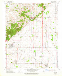
1963 Map of Morley
USGS Topo · Published 1964About this map
Benton and Morley serve as the primary anchors of this Scott County landscape in the early 1960s, showing a region defined by the intersection of rail infrastructure and structured drainage. The Missouri Pacific railroad cuts a diagonal path through the terrain, linking the smaller settlements of Hayward City and Blodgett. The mapping reveals a high concentration of small family and community burial sites, such as Lambert Cem and Hickory Grove Cem, which are essential markers for local genealogical research.
Find a feature on this map
23 named features on this map. Tap any name to fly to it.
Don’t see what you’re looking for? This feature index may not catch every label — zoom into the map to look around manually.
Map Details
Editions of this 1963 Morley Map
2 editions found
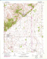
Other maps of this area

1931 · Sikeston
USGS Topo · 1:62,500

1934 · Thebes
USGS Topo · 1:62,500

1934 · Morley
USGS Topo · 1:62,500

1934 · Sikeston
USGS Topo · 1:62,500

1939 · Sikeston
USGS Topo · 1:62,500

1939 · Charleston
USGS Topo · 1:62,500

1939 · Morley
USGS Topo · 1:62,500

1939 · Thebes
USGS Topo · 1:62,500

1949 · Paducah
USGS Topo · 1:250,000

1950 · Paducah
USGS Topo · 1:250,000