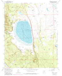
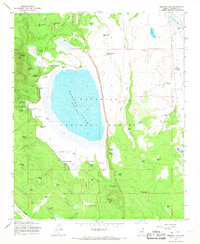
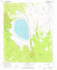
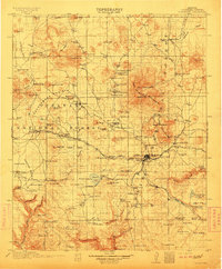
1965 Map of Mormon Lake
USGS Topo · Published 1984About this map
Mormon Lake dominates this high-altitude landscape within the Coconino National Forest, its fluctuating shoreline defining the local geography. During this mid-century period, the area serves as a concentrated hub for forest management and recreation, anchored by the Mormon Ranger Station and the Mormon Lake Lookout Tower. The western and southern shores are dotted with seasonal and organizational camps like Tempe Camp, Lakeview, and the St Joseph Youth Camp. Notable for genealogists and researchers are the numerous family-named and historical water sources, including Wallace Spring, Smith Spring, and Lockwood Spring, which provided essential water in this volcanic terrain. A trace of industrial history persists in the north and west, where an Old Grade and segments of an Industrial Railroad mark the paths of earlier logging operations that once moved timber through Long Park and across the flats near Pine Grove Hill.
Find a feature on this map
77 named features on this map. Tap any name to fly to it.
Don’t see what you’re looking for? This feature index may not catch every label — zoom into the map to look around manually.
Map Details
Editions of this 1965 Mormon Lake Map
4 editions found

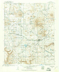
Other maps of this area

1886 · San Francisco Mtns
USGS Topo · 1:250,000

1887 · Verde
USGS Topo · 1:250,000

1891 · San Francisco Mtns
USGS Topo · 1:250,000

1892 · Verde
USGS Topo · 1:250,000

1894 · San Francisco Mtns
USGS Topo · 1:250,000

1899 · San Francisco Mtns
USGS Topo · 1:250,000
1908 · Flagstaff
USGS Topo · 1:125,000
1912 · Flagstaff
USGS Topo · 1:125,000

1923 · Camp Verde
USGS Topo · 1:125,000

1932 · Camp Verde
USGS Topo · 1:125,000