
1965 Map of Mormon Lake
USGS Topo · Published 1984About this map
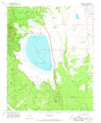
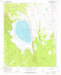
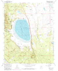
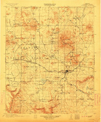
Mormon Lake and its surrounding high-country terrain dominate this mid-century survey of the Coconino National Forest. Recorded at an elevation of 7,107 feet in 1965, the lake serves as the central hub for local activity, bordered by the settlement of Mormon Lake and the smaller community at Lakeview. The landscape is dotted with a high density of water sources essential for ranching and forestry, including Dairy Spring, Smith Spring, and numerous stock tanks like Breezy No 2 Tank. Evidence of former commercial infrastructure appears via the Old Grade Railroad and the Industrial Railroad, which once moved timber through these woods. Local social and administrative history is anchored by the Mormon Ranger Station, St Joseph Youth Camp, and the Flying M Ranch, while the Mormon Lake Lookout Tower stands as a sentinel over the plateau.
Find a feature on this map
78 named features on this map. Tap any name to fly to it.
Don’t see what you’re looking for? This feature index may not catch every label — zoom into the map to look around manually.
Map Details
Editions of this 1965 Mormon Lake Map
4 editions found
Other maps of this area

1886 · San Francisco Mtns
USGS Topo · 1:250,000

1887 · Verde
USGS Topo · 1:250,000

1891 · San Francisco Mtns
USGS Topo · 1:250,000

1892 · Verde
USGS Topo · 1:250,000

1894 · San Francisco Mtns
USGS Topo · 1:250,000

1899 · San Francisco Mtns
USGS Topo · 1:250,000
1908 · Flagstaff
USGS Topo · 1:125,000
1912 · Flagstaff
USGS Topo · 1:125,000

1923 · Camp Verde
USGS Topo · 1:125,000

1932 · Camp Verde
USGS Topo · 1:125,000