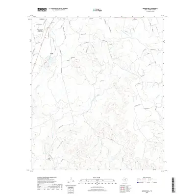
2019 Map of Mormon Mill
USGS Topo · Published 2019About this map
The rugged landscape south of Burnet is defined by the winding descent of Hamilton Creek and the historical footprint of the Mormon Mill settlement. In this 2019 survey, the network of small family burial grounds including Morman Mill Cem, Holland Cem, and Norred Cem provides a detailed record of the area's pioneer genealogy and rural settlement patterns. The topography transitions from the residential outskirts of the county seat near Burnet Municipal Airport Kate Craddock Field down to the creek bottom at Mill Pond, where industrial history meets the natural springs of the Hill Country. Numerous small waterways like Hairston Creek and Sycamore Creek feed into the South Fork San Gabriel River, illustrating the complex drainage of the Edwards Plateau. The rural road network, notably Mormon Mills Rd, follows the high ridges and deep hollows, such as Burger Hollow, that have dictated travel through these ranchlands for generations.
Find a feature on this map
64 named features on this map. Tap any name to fly to it.
Don’t see what you’re looking for? This feature index may not catch every label — zoom into the map to look around manually.
Map Details
Editions of this 2019 Mormon Mill Map
This is the sole edition of this map. No revisions or reprints were ever made.
Other maps of this area

1887 · Burnet
USGS Topo · 1:125,000

1893 · Burnet
USGS Topo · 1:125,000

1903 · Burnet
USGS Topo · 1:125,000

1909 · Burnet
USGS Topo · 1:125,000

1925 · Burnet 3-d
USGS Topo · 1:48,000

1929 · Marble Falls
USGS Topo · 1:62,500

1932 · Tow
USGS Topo · 1:62,500

1932 · Marble Falls
USGS Topo · 1:62,500

1932 · Bertram
USGS Topo · 1:62,500

1954 · Llano
USGS Topo · 1:250,000