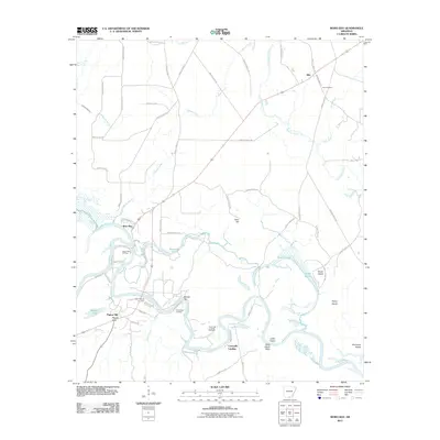
2011 Map of Moro Bay
USGS Topo · Published 2011About this map
The Ouachita River winds through this South Arkansas landscape, defining a region where river navigation and the energy industry intersect. This 2011 survey documents a geography of river bends and islands, including Kemp Island and Jacks Island, alongside evidence of the area's subterranean resources. Multiple active extraction sites like the Pigeon Hill Oil Field, Lick Creek Oil Field, and River Bend Oil Field are scattered near the riverbanks, illustrating the economic importance of the petroleum sector in Bradley County.
Find a feature on this map
69 named features on this map. Tap any name to fly to it.
Don’t see what you’re looking for? This feature index may not catch every label — zoom into the map to look around manually.
Map Details
Editions of this 2011 Moro Bay Map
This is the sole edition of this map. No revisions or reprints were ever made.
Other maps of this area

1933 · Strong
USGS Topo · 1:62,500

1934 · Ingalls
USGS Topo · 1:48,000

1934 · Felsenthal
USGS Topo · 1:62,500

1934 · Moro Bay
USGS Topo · 1:62,500

1937 · Strong
USGS Topo · 1:62,500

1937 · Felsenthal
USGS Topo · 1:62,500

1937 · Ingalls
USGS Topo · 1:62,500

1938 · Felsenthal
USGS Topo · 1:62,500

1938 · Moro Bay
USGS Topo · 1:62,500

1939 · Felsenthal
USGS Topo · 1:62,500