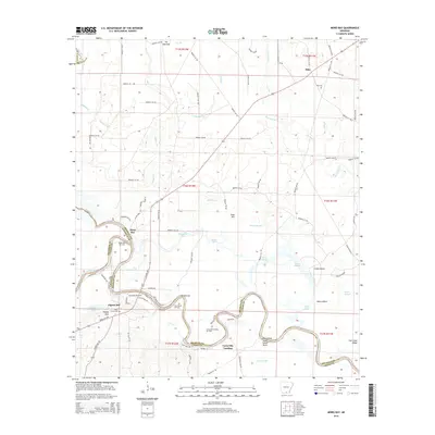
2014 Map of Moro Bay
USGS Topo · Published 2014About this map
The Ouachita River defines the southern portion of this landscape, its winding course forming the boundary between Bradley and Union counties. The river valley is a complex network of sloughs and islands, including Deep Slough, Green Island, and Jacks Island Bend. Industrial activity is a primary feature of the region, with the Pigeon Hill Oil Field, River Bend Oil Field, and Careyville Landing Oil Field indicating a heavy reliance on petroleum extraction.
Find a feature on this map
98 named features on this map. Tap any name to fly to it.
Don’t see what you’re looking for? This feature index may not catch every label — zoom into the map to look around manually.
Map Details
Editions of this 2014 Moro Bay Map
This is the sole edition of this map. No revisions or reprints were ever made.
Other maps of this area

1933 · Strong
USGS Topo · 1:62,500

1934 · Ingalls
USGS Topo · 1:48,000

1934 · Felsenthal
USGS Topo · 1:62,500

1934 · Moro Bay
USGS Topo · 1:62,500

1937 · Strong
USGS Topo · 1:62,500

1937 · Felsenthal
USGS Topo · 1:62,500

1937 · Ingalls
USGS Topo · 1:62,500

1938 · Felsenthal
USGS Topo · 1:62,500

1938 · Moro Bay
USGS Topo · 1:62,500

1939 · Felsenthal
USGS Topo · 1:62,500