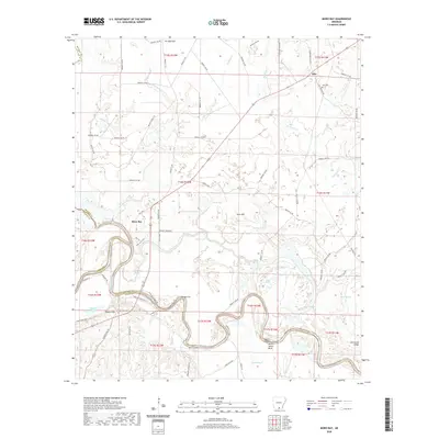
2020 Map of Moro Bay
USGS Topo · Published 2020About this map
The Ouachita River snakes through the southern reaches of this landscape, defining the boundary between Bradley, Calhoun, and Union counties. Along these winding banks, historical river access points like Cotys Lndg, Pigeon Hill Lndg, and Careyville Lndg reflect a long-standing reliance on the waterway for transport and recreation. The interior is a complex network of wetlands and seasonal water bodies, including the expansive Bilbo Lake and the serpentine Romeo Cut, which speak to the shifting nature of the river's course over time.
Find a feature on this map
87 named features on this map. Tap any name to fly to it.
Don’t see what you’re looking for? This feature index may not catch every label — zoom into the map to look around manually.
Map Details
Editions of this 2020 Moro Bay Map
This is the sole edition of this map. No revisions or reprints were ever made.
Other maps of this area

1933 · Strong
USGS Topo · 1:62,500

1934 · Ingalls
USGS Topo · 1:48,000

1934 · Felsenthal
USGS Topo · 1:62,500

1934 · Moro Bay
USGS Topo · 1:62,500

1937 · Strong
USGS Topo · 1:62,500

1937 · Felsenthal
USGS Topo · 1:62,500

1937 · Ingalls
USGS Topo · 1:62,500

1938 · Felsenthal
USGS Topo · 1:62,500

1938 · Moro Bay
USGS Topo · 1:62,500

1939 · Felsenthal
USGS Topo · 1:62,500