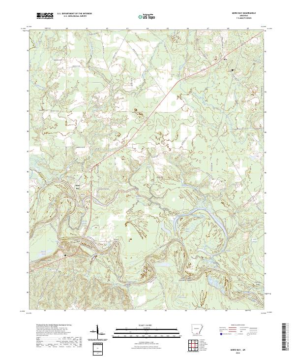
2024 Map of Moro Bay
USGS Topo · Published 2024About this map
The confluence of Moro Creek and the Ouachita River defines this riverine landscape, where the borders of Bradley, Calhoun, and Union counties meet. This modern survey illustrates the complex hydrology of the bottomlands, characterized by a dense network of secondary waterways like Paw-Paw Slough, Bilbo Lake, and Deep Slough. The terrain rises toward Cane Hill and the Pigeon Hills in the southwest, providing a stark contrast to the flood-prone flats. In the northern reaches, the small settlement of Hilo and its accompanying Hilo Cem provide touchpoints for local family history. The meandering path of the river is punctuated by features such as Romeo Cut and Jacks Island, reflecting the dynamic nature of the regional drainage system. The road network, including Hilo-Marsden Rd and various Bradley County routes, connects these isolated riverside areas to the interior timberlands.
Find a feature on this map
91 named features on this map. Tap any name to fly to it.
Don’t see what you’re looking for? This feature index may not catch every label — zoom into the map to look around manually.
Map Details
Editions of this 2024 Moro Bay Map
This is the sole edition of this map. No revisions or reprints were ever made.
Other maps of this area

1933 · Strong
USGS Topo · 1:62,500

1934 · Ingalls
USGS Topo · 1:48,000

1934 · Felsenthal
USGS Topo · 1:62,500

1934 · Moro Bay
USGS Topo · 1:62,500

1937 · Strong
USGS Topo · 1:62,500

1937 · Felsenthal
USGS Topo · 1:62,500

1937 · Ingalls
USGS Topo · 1:62,500

1938 · Felsenthal
USGS Topo · 1:62,500

1938 · Moro Bay
USGS Topo · 1:62,500

1939 · Felsenthal
USGS Topo · 1:62,500