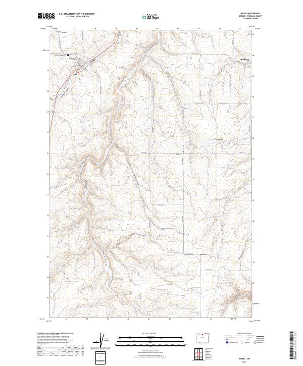
2023 Map of Moro
USGS Topo · Published 2023About this map
Moro serves as the focal point of this high plateau landscape, anchored by the Sherman County Courthouse and a grid of streets including Main St and Court St. The town sits at the head of Barnum Canyon, surrounded by a vast network of wheat-country roads like Lone Rock Rd and Douma Rd that trace the undulating terrain of Sherman County. To the east, the small settlement of Monkland is reached via Monkland Ln, positioned near the heights of Rose Hill.
Find a feature on this map
37 named features on this map. Tap any name to fly to it.
Don’t see what you’re looking for? This feature index may not catch every label — zoom into the map to look around manually.
Map Details
Editions of this 2023 Moro Map
This is the sole edition of this map. No revisions or reprints were ever made.
Other maps of this area

1953 · The Dalles
USGS Topo · 1:250,000

1956 · The Dalles
USGS Topo · 1:250,000

1957 · The Dalles
USGS Topo · 1:250,000

1957 · Wasco
USGS Topo · 1:62,500

1957 · Wishram
USGS Topo · 1:62,500

1962 · Erskine
USGS Topo · 1:24,000

1962 · Grass Valley
USGS Topo · 1:24,000

1970 · Indian Cove
USGS Topo · 1:24,000

1970 · Rosebush
USGS Topo · 1:24,000

1971 · Moro
USGS Topo · 1:24,000