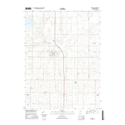
2016 Map of Morocco
USGS Topo · Published 2016About this map
Morocco serves as the primary hub in this portion of Newton County, where the town grid is established at the intersection of local routes and surrounded by an extensive network of drainage infrastructure. This hydraulic engineering is central to the area's agricultural identity, evidenced by named waterways such as Lawler Ditch, Salisbury Ditch, and Deardurff Ditch that crisscross the landscape to manage the high water table characteristic of this Indiana region. The northern section of the map is defined by J C Murphey Lake, providing a significant contrast to the structured township and range system that organizes the surrounding farmland.
Find a feature on this map
66 named features on this map. Tap any name to fly to it.
Don’t see what you’re looking for? This feature index may not catch every label — zoom into the map to look around manually.
Map Details
Editions of this 2016 Morocco Map
This is the sole edition of this map. No revisions or reprints were ever made.
Other maps of this area

1922 · Momence
USGS Topo · 1:62,500

1924 · Momence
USGS Topo · 1:62,500

1935 · Watseka
USGS Topo · 1:48,000

1939 · Watseka
USGS Topo · 1:62,500

1953 · Chicago
USGS Topo · 1:250,000

1953 · Danville
USGS Topo · 1:250,000

1955 · Danville
USGS Topo · 1:250,000

1956 · Danville
USGS Topo · 1:250,000

1957 · Chicago
USGS Topo · 1:250,000

1961 · Kentland
USGS Topo · 1:24,000