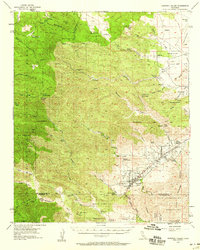
1955 Map of Morongo Valley
USGS Topo · Published 1959About this map
Morongo Valley serves as a central point in this 1950s survey of the high desert and mountains at the junction of the San Bernardino National Forest and the San Gorgonio Wild Area. The map details a landscape transition from high mountain peaks like Mineral Mtn and Kitching Peak down to the arid basins of Antelope Wash. Early industry is evident in the northern reaches, where the Rose Mine and Monte Cristo Mine are plotted near Rattlesnake Canyon. A fascinating variety of remote outposts and settlements are visible, from the established western-style Pioneertown to the more secluded Tayles Hidden Acres and The Pipes Ranch. The map also captures several springs and water sources vital to this environment, such as Sherman Shady Spring and Leopard Spring, alongside the path of the Twentynine Palms Highway.
Find a feature on this map
58 named features on this map. Tap any name to fly to it.
Don’t see what you’re looking for? This feature index may not catch every label — zoom into the map to look around manually.
Map Details
Editions of this 1955 Morongo Valley Map
3 editions found

Other maps of this area

1901 · Southern California Sheet No. 1
USGS Topo · 1:250,000

1901 · San Jacinto
USGS Topo · 1:125,000

1902 · San Gorgonio
USGS Topo · 1:125,000

1904 · Southern California Sheet No. 1
USGS Topo · 1:250,000

1940 · Palm Springs
USGS Topo · 1:62,500

1941 · Edom
USGS Topo · 1:62,500

1942 · Banning
USGS Topo · 1:62,500

1943 · Banning
USGS Topo · 1:62,500

1944 · Palm Springs
USGS Topo · 1:62,500

1944 · Edom
USGS Topo · 1:62,500