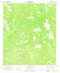
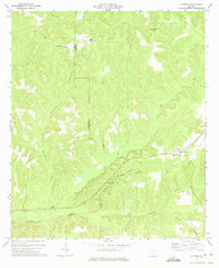
1973 Map of Morris
USGS Topo · Published 1974About this map
Morris and Springvale serve as the primary focal points of this 1970s landscape, positioned along the Central of Georgia rail corridor. The map reveals an area defined by both its agricultural roots and industrial activity, marked by several strip mines, a Tailings Pond, and a Claypit that signify active resource extraction. Local community life is grounded in long-standing landmarks like Mt Zion Ch, St Johns Ch, and the Springvale Cem, while the Perkins Lookout Tower stands as a notable sentinel in the southern reaches of the quadrangle.
Find a feature on this map
29 named features on this map. Tap any name to fly to it.
Don’t see what you’re looking for? This feature index may not catch every label — zoom into the map to look around manually.
Map Details
Editions of this 1973 Morris Map
This is the sole edition of this map. No revisions or reprints were ever made.
Other maps of this area

1953 · Dothan
USGS Topo · 1:250,000

1954 · Dothan
USGS Topo · 1:250,000

1955 · Dothan
USGS Topo · 1:250,000

1967 · Hatcher
USGS Topo · 1:24,000

1967 · Georgetown
USGS Topo · 1:24,000

1969 · Fort Gaines NE
USGS Topo · 1:24,000
1972 · Sanford
USGS Topo · 1:24,000
1972 · County Line
USGS Topo · 1:24,000
1972 · Cuthbert
USGS Topo · 1:24,000
1973 · Coleman
USGS Topo · 1:24,000